
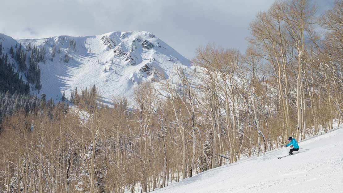
Coming up for air after 12 days of powder, I wanted to put the most recent storm cycle in perspective. Or just reminisce for personal enjoyment. Either way.
From January 2nd, when the Park City ridgeline started getting pounded with snow, until January 13th, when the sun finally reappeared, it “snowed like it used to.”
What does that mean? Take a look at Deer Valley’s snow totals over this 12-day period:

The Numbers
That’s 106 inches, or just shy of nine feet of new snow. That’s a lot of snow no matter where you are (settle down, California), but what made this storm cycle so glorious were the refills. Deer Valley reported new snow accumulation 11 out of the 12 days. Even with a brief slowdown from January 6th through the 8th (1, 0 and 2 inches respectively) the average daily new snow total during the storm was just shy of nine inches. That’s boot cuff deep. The past few seasons I skipped work for nine inches. So did my boss.
In 2014-2015 (the year we try to forget) Deer Valley didn’t surpass 106 inches for the season until March 3rd. The largest snowfall that season? 16 inches. We beat that on back-to-back days during this storm cycle and five times already since opening day.

The Science
Ok, you get it. This storm of yesteryear was awesome, and Utahns are feeling validated in their steadfast loyalty to the “Greatest Snow On Earth.” So what happened? Is some especially fleet-footed ski bum dancing for the snow gods? Does this have something to do with selling all of my fat skis at the swap this fall?
In an effort to provide an answer grounded in accepted science, I reached out to National Weather Service Senior Meteorologist, Brian McInerney. Here’s what he had to say:
“When we (the Meteorologists and Hydrologists at the National Weather Service) looked at the overall global weather pattern back in mid-November, one thing hit home – the cold pool of air that had been positioned over the Hudson Bay area and Greenland for the past five years had shifted to Eastern Siberia and Western Alaska, upstream of Utah. This is important. Utah’s weather originates out of the west. As such, we could expect a stronger gradient in the difference between cold and warm water on a giant scale. This gradient packs more energy and was expected to shift the jet stream away from the high-pressure ridging pattern we’ve seen in the past five years. High pressure is associated with nice weather, lack of storms, inverted air masses, and poor air quality in the valleys. Instead of a massive high pressure stationed over the western US, the staff surmised that we would see a more progressive weather pattern, bringing storms, cold air, and moisture in the form of snow.
Now understand, long-range forecasting beyond seven days is a risky business at best. But this was a big change, and anything to shift the stagnant western U.S, global pattern was a welcome relief.
Now shift to January 18th. Utah is experiencing a banner year so far. Snowpack averages are near 150-200% across the state. The high-pressure ridge is smaller and south of us, just west of Mexico. The skiing is fabulous and most days are powder days, as it should be.”
To get a sense for the global weather patterns Brian is talking about, I highly recommend checking out the Earth Null School maps. Below is the global temperature map.

Now look at the 3-Hour Precipitation Accumulation (3HPA) at the surface on January 9th – right before Deer Valley was pounded with three feet of snow over two days.

Thank You Ski Patrol
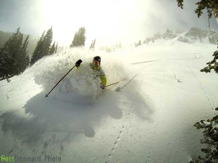
So Siberia pulled through for us and it snowed a lot in Park City. We all skied pow, and high-fived, and skipped work – standard behavior when it’s nuking. But that doesn’t mean it’s all fun and games when nine feet of new snow falls in rapid succession.
No “Storm Recap” would be complete without a shout-out to the men and women of the Ski Patrol. While freeloaders like me feel accomplished for being booted-up and in line by 8:45 AM, the snow safety efforts of the Ski Patrol have been underway for hours. Deer Valley Ski Patrol Manager, Chris Erkkila, described the morning routine when the forecast is loaded with snow:
“Planning actually starts the day before. We come up with a schedule for routes and determine how many pounds of explosives we are going to need. The first patrollers to arrive for morning routes are here at 6:00 AM. They check the weather (both past and future) and head to our explosives storage magazine to gather the shots. We’re on the chair at 6:50 AM and head to the mountain patrol building. It takes a little time to assemble the explosives and then we are out the door. Routes usually consist of a combination of cornice kicking and placing our shots. Some of the routes are easier than others and we’re able to get them open sooner. The last routes are usually done no later than 10:00 AM (conditions permitting.)”
Next time you wake up to that beautiful sound of bombs in the morning, send a mental shout-out to the ski patrollers who are already up on the hill. They’re spending the cold, dark hours of dawn breaking trail up waist-deep bootpacks so we can swoop in for the goods at our leisure. And if you hear someone complaining about patrollers “poaching all the fresh tracks,” tell them to go kick their own cornices.
With Great Snow Comes Great Responsibility
While there was plenty of snow to be had in-bounds, the prospect of even fresher lines will always draw skiers into the backcountry. It goes without saying that a storm of this magnitude increases the risks associated with skiing “un-patrolled” terrain. But that doesn’t mean the backcountry needs to be avoided entirely. With proper training and respect for the forces at play, the backcountry can be responsibly enjoyed. Our very own Avalanche Education Program Director, Scott House, explained his approach to the backcountry over the past two weeks:
“This storm was like nothing we’ve seen in the past five years. It wasn’t the snow totals but the snow water equivalent, with up to six inches of water or more in places. The snowpack is like most humans – it doesn’t like change. With that much extra water it was a waiting game, and we had to give the snowpack time to adjust. During this storm it was important to follow the Utah Avalanche Center forecasts to see how the snow was adjusting, and what other skiers were finding around the Wasatch. You could find good skiing on low-angle slopes – with nothing steep above or below – on the northern half of the compass. With a little bit of time the snowpack adjusted nicely to the new load and with careful evaluation and good route finding you could start to step out into steeper terrain.”

Keep Dancing
Alright, let’s get to the question we all want an answer to: Is it going to keep snowing? Brian, what are the global weather patterns saying?
“Will the progressive pattern continue? Again, understand that we don’t do very well beyond seven days, and the short-term forecast calls for smaller storms and a bit of high-pressure ridging. We don’t want high pressure. It dominated our winter weather pattern for the past five years. But we look and Voila! The cold pool remains over Siberia and Alaska, and not so much over the Hudson Bay and Greenland. Granted, there are many variables that could derail our awesome powder forecast, but the big picture is intact, and we are optimistic that the storms will continue. Let’s cross our fingers and dance to the snow gods that the powder days will continue.”
How intense is the addiction to powder? It can make a scientist superstitious. So cross your fingers, flail your feet, and bring on the progressive weather pattern. With the right mix of science and luck, we just might be treated to a season like the old days. Until I get new powder skis and ruin it for everyone.
Special thanks to Brian McInerney, Chris Erkkila, and Scott House for their professional insight.
Nate Tomlinson, Senior Content Writer


